
Hike the Tennessee River Gorge on the Ritchie Hollow Trail
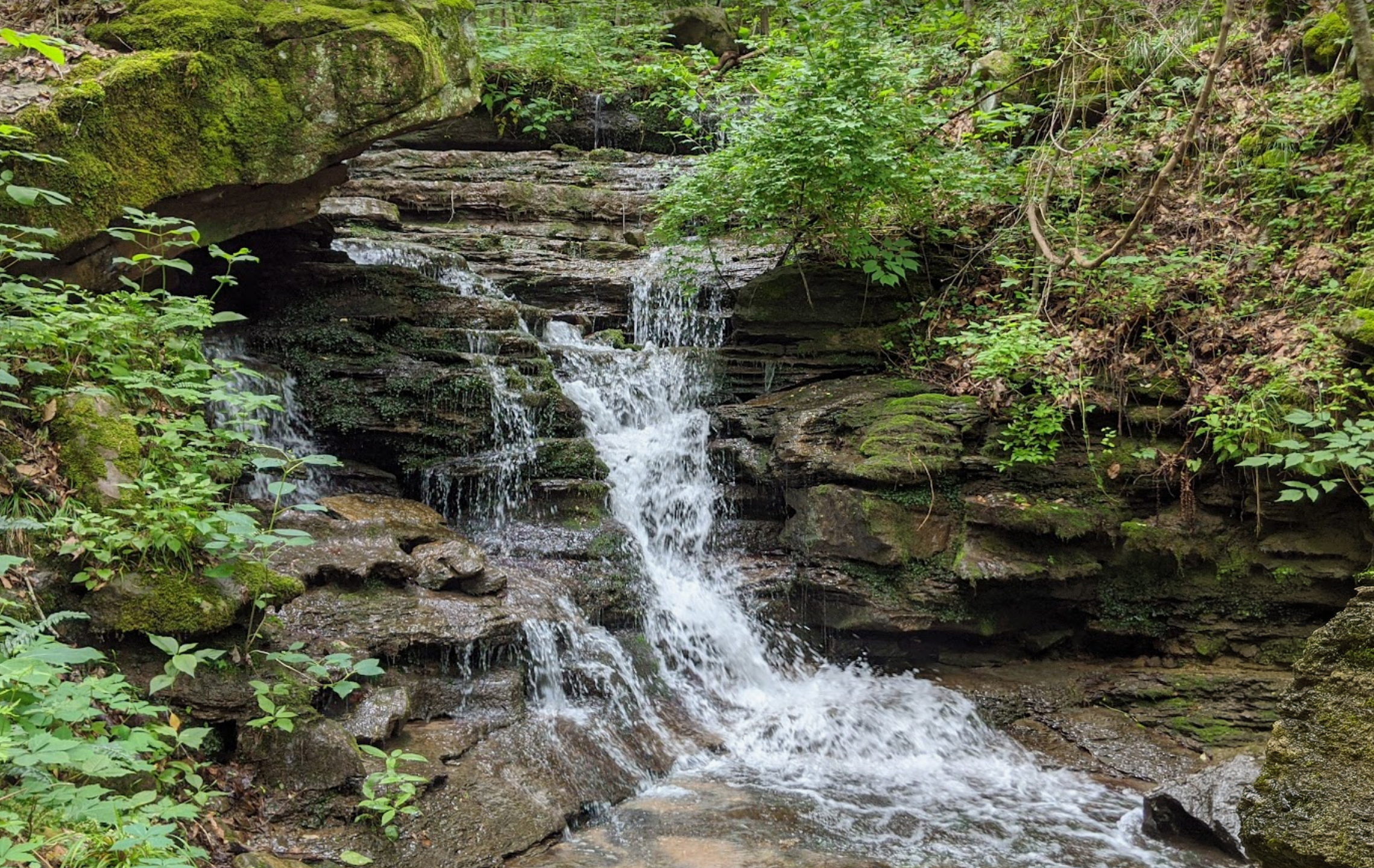
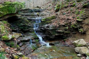
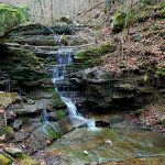
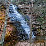
The Ritchie Hollow Trail, having opened in January 2018, offers one of the newest ways to hike the Tennessee River Gorge. It climbs 2.7 miles one way from the Tennessee River to Davis Pond on top of the Cumberland Plateau in the Prentice Cooper State Forest and Wildlife Management Area. Along the way, it crosses the Pot Point Loop Trail, passes the highlight of the hike, the 30-foot Blowing Wind Falls, and gains about 1,200 feet in elevation.
 Two alternatives to the 5.4-mile round-trip hike are to simply hike to Blowing Wind Falls from either end and then retrace your route. The 3.6-mile round-trip hike to the falls from the base of the mountain begins on Tennessee River Gorge Trust property on River Canyon Road across from the Pot Point Cabin. The trailhead is at the opposite end of the parking area from the Pot Point Nature Trail loop. The trail soon enters Prentice Cooper State Forest, climbing gradually for awhile as it somewhat parallels the Tennessee River through mature hardwood forest, crosses a couple of tumbling streams, and passes the sites of historic moonshine stills.
The trail climbs more steeply as it works its way up into Ritchie Hollow, eventually arriving at the cascading Blowing Wind Falls about 700 feet higher in elevation than the trailhead. A short spur on the right drops steeply along the base of a cliff to reach the falls.
An easier hike at half the length is to descend to the falls from the Davis Pond trailhead for a 1.8-mile round-trip hike. The main drawback to this option is that it involves driving nearly eight miles of gravel road. But the trailhead is well marked and has ample parking, along with a primitive campground. In about 0.5 miles, the trail crosses the 12-mile Pot Point Loop Trail, part of the Cumberland Trail system. From there, it’s about 0.4 miles to Blowing Wind Falls, which from this direction, is a little over 400 feet in elevation lower than the trailhead. While it’s an uphill hike back, this version is significantly less strenuous than hiking up to the falls from the river.
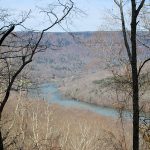
An option which would add a total of 3.2 miles to the upper hike, or 4 miles to the lower version is to hike east for 1.6 miles on the Pot Point Loop Trail from its junction with the Ritchie Hollow Trail to the Snoopers Rock Overlook, with its spectacular view of the Tennessee River Gorge. Since you can drive to Snoopers Rock (with about 6 miles of gravel road), this can also serve as an alternate trailhead. For example, hiking to Blowing Wind Falls from Snoopers Rock would be an approximately 4-mile round-trip hike.
The Ritchie Hollow Trail is currently the only hiking trail on the northern side of the Tennessee River Gorge which connects the river with the top of the plateau, and thus provides another way to explore the rugged and biodiverse mountainside forests of the gorge.
Note: Prentice Cooper State Forest is closed to hikers on certain dates for Spring turkey hunts and Fall deer hunts. To avoid these dates, check the Prentice Cooper website.
Directions
The Pot Point Cabin trailhead: GPS 35.089347,-85.399415 Or, search Ritchie Hollow Trail on Google Maps. The trailhead is 4.2 miles out River Canyon Road from Suck Creek.
The Davis Pond trailhead: GPS 35.082024,-85.430120 Or, search Davis Pond Road on Google Maps.
Snooper’s Rock GPS 35.101626,-85.425283 Or, search Snooper’s Rock Parking Area on Google Maps.
For more information
View a map of the trail, watch a video about Ritchie Hollow, and learn about the Tennessee River Gorge Trust and the partnerships involved in creating the trail here.
Article by Bob Butters

Recent Posts

 Discover Ten Mile, Tennessee: The Hidden Lakefront Gem of Meigs CountyOctober 23, 2025
 Discover Copperhill, Tennessee: History, Train Rides, and Riverfront CharmJuly 28, 2025
 Discover Calhoun: Tennessee’s Hidden Riverfront GemJuly 10, 2025
 Savage Gulf State ParkNovember 4, 2024
 Bike TNMay 23, 2024